My bearhound, Beans, is in her 90's, but I was tempted to take her on this hike anyway. She accompanied me to the area in 2006 and I thought of her many times during this trip. The previous trip was primarily to visit the Red Rock Basin. The conditions in early July, 2006 were very different from the ones I found this time. Snow covered much of the higher elevations then and on this trip there was no snow to be seen anywhere. As a matter of fact, there was very little water. Later in the trip I caught myself taking a movie of water flowing from a spring, it seemed so novel.
After a number of years of declining conditioning, I realized I would either have to lose some weight and work out or quit hiking. I joined a gym in the Spring of 2012 and found that hiking the next Summer was much more pleasant than it had been in years. This year I have felt even better and thought I might be able to make the 13 mile hike to Rae Lake in a day. Well, I did. Not only that, but I didn't feel completely hammered when I got there. The trip was through exceptionally dry country, not unexpected after two low-snow years in a row. On a trip to the area a few weeks earlier, I discovered that Post Corral Creek was not flowing until Burnt Corral Creek joined it. That's dry!
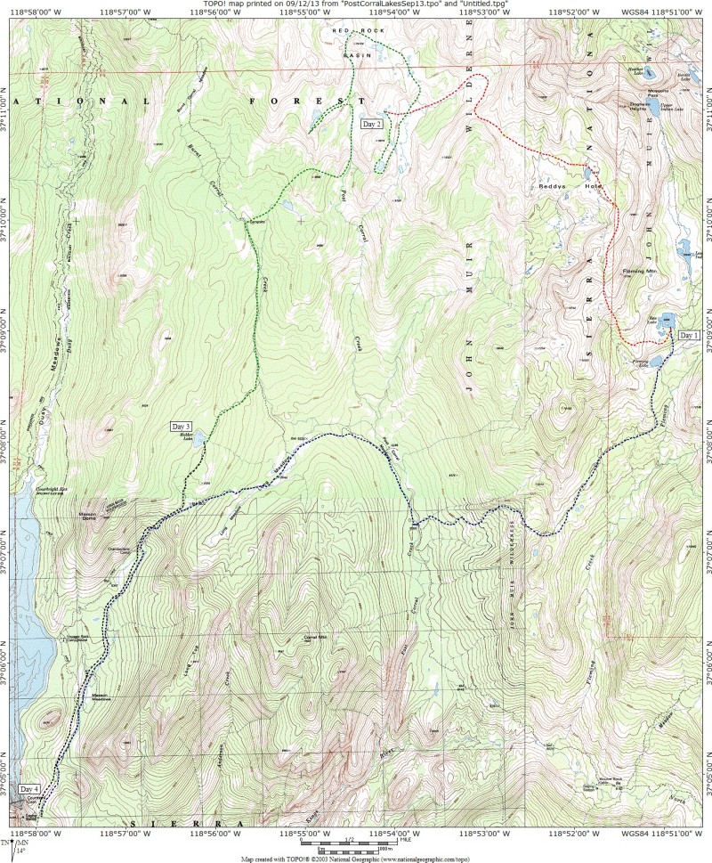
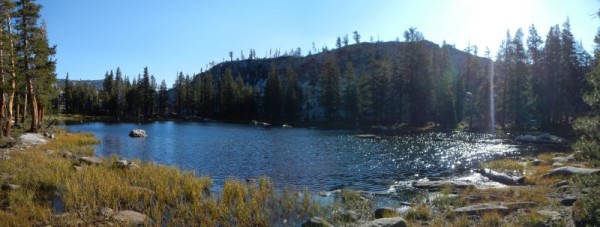
Rae Lake with Fleming Mountain on the horizon at the beginning of Day 2.
My goal for the trip was to visit as many of the lakes in the headwaters of Post Corral Creek as I could. In August of 2006, Beans and I had climbed Fleming Mountain which is just west of Rae Lake. There was a great view of Reddys Hole from the mountain and I knew I had to visit it some time. On that trip, Beans and I descended Fleming Mountain to the south and found a nice route down to Rae Lake. I decided that I would reverse that route on this trip and it worked well. I have been devoting a lot of time to botany on many of my recent trips, but I figured everything would be dried up and the flowers wouldn't slow me down. What a surprise to find so many of them blooming on the pass between Fleming Creek and Post Corral Creek.
Reddys Hole from pass between Fleming Creek and Post Corral Creek watersheds.
I soon found a distinct use trail that led me toward Reddy's Hole.
Use trail leading to Reddys Hole.
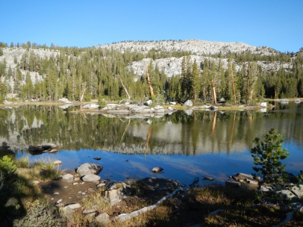
It looked like I'd be there in half an hour. From the pass, I didn't see the deep cirque I would have to detour around working around it slowed my progress.
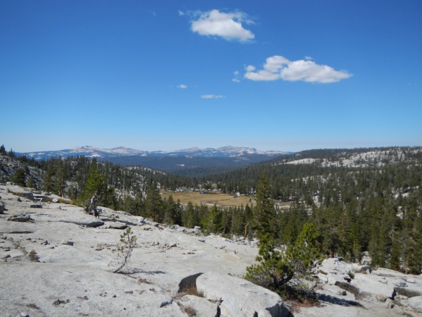
The upper reaches of Post Corral Creek are dominated by glacial terraine that make navigation in the area sometimes confusing and/or difficult, like having to work around this meadow filled cirque.
I reached the lake in Reddys Hole almost two hours after leaving the pass.
This is the pond in Reddys Hole
After a lunch break and photographing a few more flowers, I began what was one of the most adventurous sections of the trip. At first it was easy. Remnants of use trail led me through a meadow west of Reddys Hole.
The use trail west of Reddys Hole hadn't seen much traffic lately
Then I lost the trail. After a while, I took a look at my GPS and realized I had ascended the wrong valley. I had to cross a lot of broken terrain to get back on track. Even then, the way didn't seem obvious. I worked my way around many deep cracks in the granite and finally arrived at a place where I might descend into the meadow below which fed into the middle branch of Post Corral Creek.
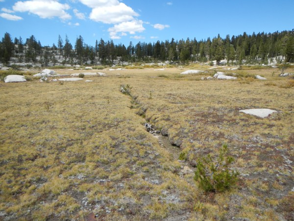
This meadow is growing in the upper reaches of the east fork of the middle fork of Post Corral Creek
Descent to the meadow was easier than expected and soon I was following the dry creek bed down to another meadow I had visited a few weeks earlier. I decided against hiking to a hidden lake I had seen on my last trip because I thought it would be too dark. From above on my earlier trip, the lake looked like it was in a hole. So instead, I walked west to a smaller lake and soon found a nice spot to set up camp. I slept well again, thanks to having switched from a Neo air mattress to my 25+ year old minimally thick Thermarest.
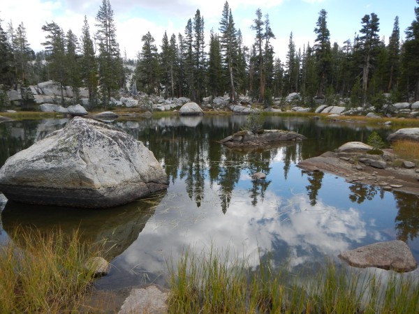
I camped next to this small lake a couple of low ridges west of the huge middle fork meadow.
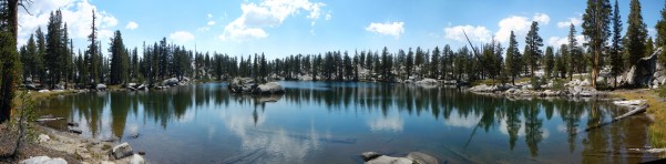
On the morning of the third day, I headed over to the hidden lake and discovered it would have been a great place to stay. There were lots of flat spots and nice views to the south and west. A cliff east of the lake added charm rather than making the lake feel enclosed. I walked around the lake and discovered a belated Happy Birthday greeting - a balloon someone had sent from the Valley. I cleaned glops of pollen paste off of it, emptied it of some water, and put it in my trash bag.
This turned out to be a scenic lake with several nice camp spots.
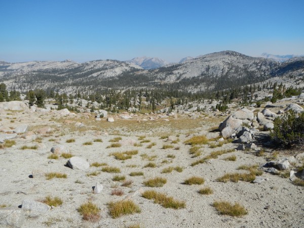
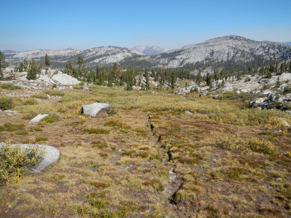
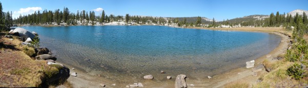
I walked north to the head of the meadow and hiked toward Red Rock Basin, on use trail much of the way. After the short ascent of the creek I found yet another of the many meadows that dot the upper reaches of the Post Corral Creek headwaters. Staying on use trail led to the largest lake in Red Rock Basin and it is a fine one. I ate lunch at a lovely spot among trees on a tiny peninsula on the north edge of the lake.
This is the largest lake in the Red Rock Basin.
After lunch, I followed use trail down to the next fork of the creek to the west. Branching off of this fork took me to my last new lake. Ducks helped me find the way part of the time but the GPS was most helpful in getting there. There was plenty of evidence of prior visits and a huge campsite at the south end of the lake has marvelous views to the south and east.
This lake lies west of the west fork with a large packer camp at its south end and great views to the south and east.
I left the lake thinking that soon I would be on trail that would return me to Burnt Corral Creek. I found the cirque meadow with its small pond and descend the creek bed toward the trail. But, where was it? I checked three benches for signs of it without luck. I didn't check out a low bench where the trail probably was and just decided to head cross country instead. It wasn't the brightest decision. Soon I was navigating over very steep terraine. I pulled out the GPS and spotted the gap I needed to go through next and decided that the trail must be far below. Rather than drop down to it I contoured through steep, broken granite until I reached the gap and rejoined the trail. I'm not sure how much more time I spent on this off trail section, but I did see some neat flowers I would have missed had I used the trail. Descent toward Burnt Corral Creek was fast and easy until I decided to turn off toward a shallow lake where I planned to spend the night. I pulled out the GPS and promptly began ignoring it. After a few minutes, I realized that I was farther from the lake than when I started and that I was slogging along a swampy creek. A huge stand of flowers were my reward for not following the GPS. On the down side, I tripped over some barbed wire left over from days when cattle were corraled in the area. Once I realized I was going the wrong direction, I changed course and paid closer attention to the GPS. Soon, I arrived at Burnt Corral Creek and the trail next to it that leads to the trailhead.
I decided I would camp right there. After all, it was a little after five and I'd had a big day. After sitting down for five minutes, plans changed. There was too much light left in the day and Hobler Lake was not too far away. Almost two hours later, I finally arrived at Hobler Lake. I guess I underestimated the distance. What looked like a little over a mile turned out to be almost three. After a good night's rest, I returned to the trailhead before noon.